La Mina Falls: Trail Status, Swimming Rules, And What Tours Actually Visit
La Mina Falls is the waterfall most people picture when they book an El Yunque tour, a 35-foot drop into a mountain pool at the end of two Civilian Conservation Corps trails. Its status decides which listing is worth buying that week, so this guide covers the current situation, what tours can honestly deliver, and where to swim instead.
Short answer
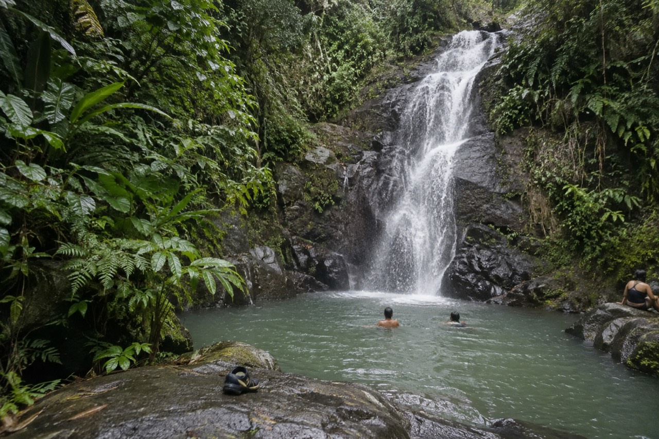
La Mina Falls drops 35 feet into a pool in the La Mina Recreation Area, reached by the 0.7-mile La Mina Trail or the 0.9-mile Big Tree Trail. The Forest Service lists both trails in its trail status alert and says the falls remain closed for construction. Check the official alerts page before booking any tour that promises them.
What Is La Mina Falls And Why Does Every Tour List Mention It?
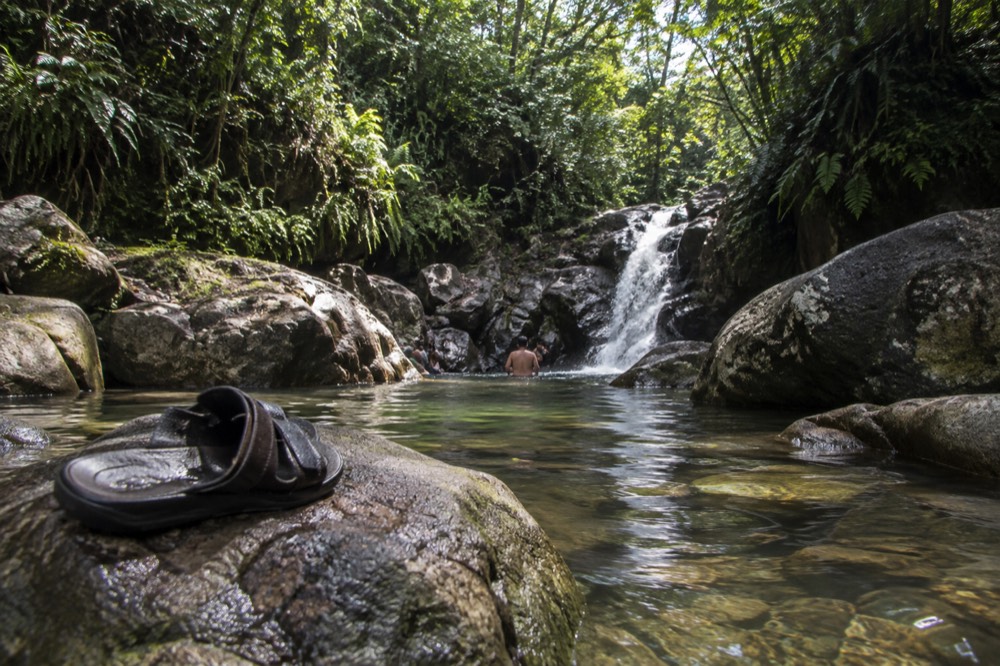
La Mina Falls is a 35-foot waterfall that drops over a rock face into a natural pool inside the La Mina Recreation Area, reached by two trails built by the Civilian Conservation Corps in the 1930s. For decades it was the forest's signature swimming stop, which is why so much El Yunque tour marketing still leads with it today.
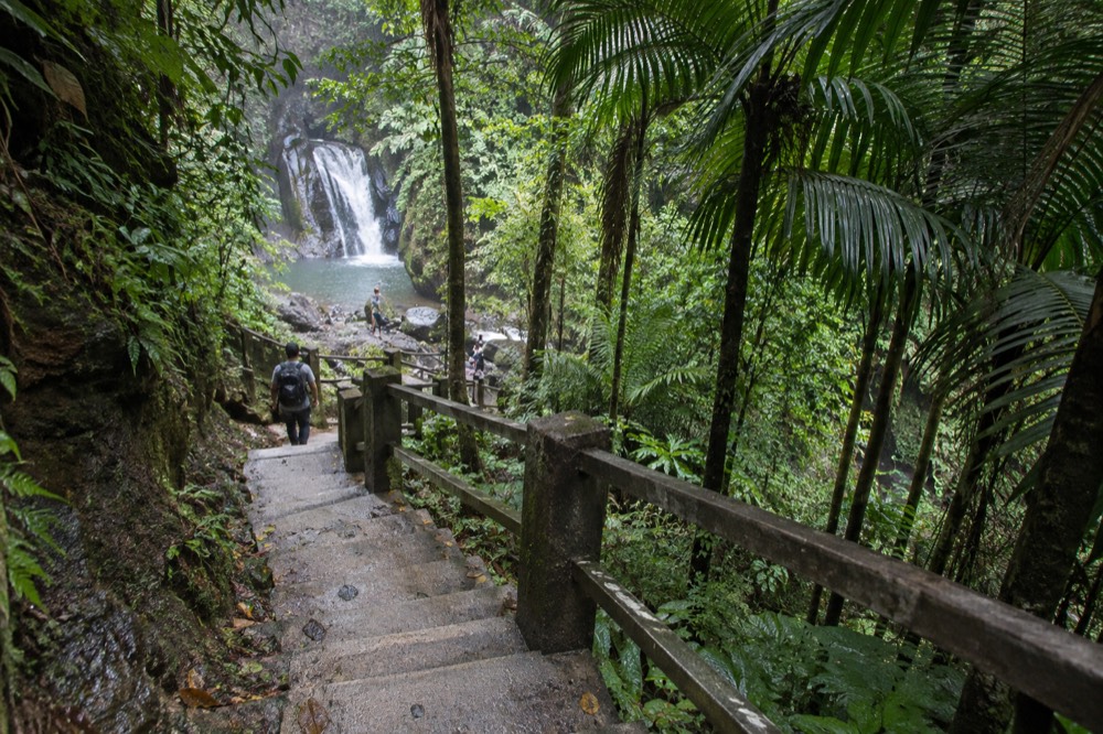
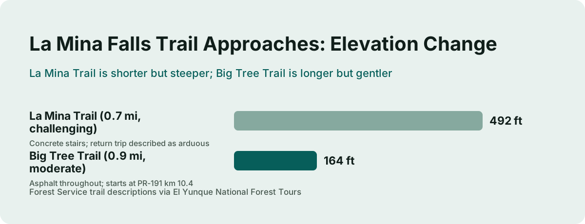
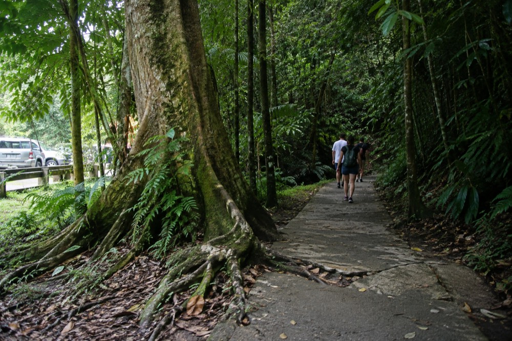
The falls sit at the end of two historic approaches off PR-191. The La Mina Trail starts at the Palo Colorado Information Center at kilometer 12.2 and runs 0.7 miles with 492 feet of elevation change, a route the Forest Service itself describes as challenging, with several sets of winding concrete stairs that make the return trip arduous. The Big Tree Trail begins at kilometer 10.4, runs 0.9 miles over asphalt with 164 feet of elevation change, and is named for the large Tabonuco trees along its length. Stone picnic shelters near the La Mina trailhead were built by the Civilian Conservation Corps during the 1930s, part of the same 1940s road-and-facility construction era that shaped most of the recreation corridor.
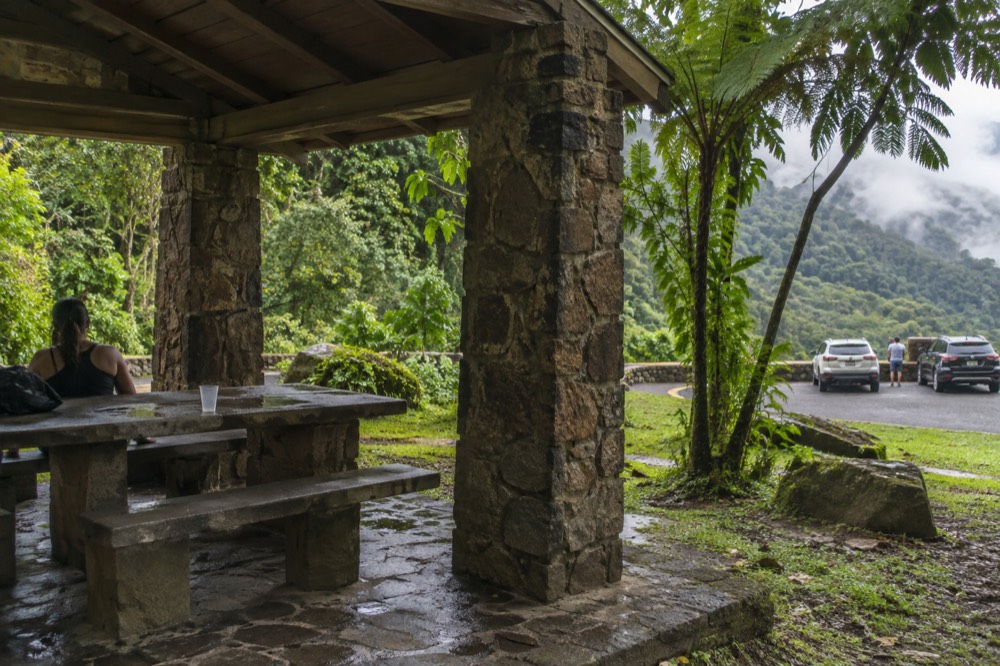
The waterfall's pull is easy to understand. The Forest Service's own Big Tree Trail description calls it "an exquisite waterfall," and for years the reward at the bottom was a pool where hikers could swim in 60-to-65-degree water after a hot climb. That combination, a short-ish hike, a dramatic cascade and a swimmable pool, made La Mina the single most requested stop in the forest, and tour operators built their itineraries and their marketing around it.
That history is exactly why this page exists. A large amount of third-party content, including live tour listings, still describes La Mina Falls as a working stop with swimming, because the copy was written when the trails were open. A reader choosing a tour this week needs to know what the Forest Service currently says, what a listing is actually selling, and which waterfall experiences are genuinely available.
Is La Mina Falls Open Right Now?
The Forest Service's standing answer is that the La Mina trail and falls remain closed for construction, and the same trail status alert lists Big Tree Trail, the second approach, as closed too. Both routes in are affected, so the only reliable source is the official alerts page, which the Forest Service updates as recovery work progresses.
The Forest Service's FAQ addresses the question directly, saying the trail and falls remain closed and attributing the situation to the significant damage hurricanes Irma and Maria caused across the entire forest, with recovery still ongoing. The forest trails status alert is the live authority on this, and it is the page to check in the week you travel, because construction and storm-recovery statuses in El Yunque change without much notice.
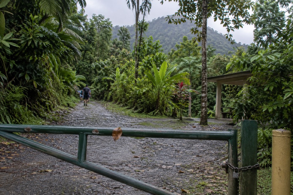
This is the single most important fact for anyone comparing tours, and it is where a lot of travel content goes wrong. A listing that promises La Mina Falls as a stop is repeating copy from before the closure, and a listing that promises swimming there is repeating copy from even further back. Neither tells you what you will actually see. The honest question to ask of any waterfall tour is not "does it mention La Mina" but "which water features are on the confirmed itinerary, and are they open this week."
The good news is that the forest itself remains fully open and free to enter. The current conditions page states that entrance to the PR-191 North recreational corridor in Río Grande is free and requires no reservation, with hours from 8:00 a.m. to 5:00 p.m. A closed waterfall inside the forest is not a closed forest, and the river-and-slide experiences that replaced La Mina in most itineraries are real, permitted and running daily.
With the falls themselves off the table for now, the tours worth comparing are the ones built around the river network that is open. These three cover the range: a small-group waterfall and slide trip, a snacks-included river day, and a longer beach-buggy-plus-waterfall combo.
Do Any Tours Actually Visit La Mina Falls?
No tour can currently put you at the base of La Mina Falls, because both trails that reach it are in the closed set, and a listing that promises the stop is repeating pre-closure copy. What waterfall tours in the area actually deliver is the wider river network: Las Tinajas, Charco Frío, the Río Mameyes pools and the Luquillo-side slides.
That distinction matters when you read a listing. Some operators describe their route as an El Yunque waterfall tour and then visit waterfalls and swimming holes that are either outside the national forest boundary, on private land, or on rivers the Forest Service does manage but that are not La Mina. None of that is dishonest on its face, but the name on the tin is not the stop you might be picturing. The fix is simple: read the confirmed stops on the listing before you book, and treat any mention of La Mina itself as a red flag that the copy is stale.
The strongest current option in this family is the Small-Group El Yunque Waterfall & Waterslides with Pickup tour, rated 4.8 across 3,040 reviews and priced from $63 for a 4-to-5-hour day with hotel pickup and free cancellation. Its confirmed stops are Las Tinajas and Charco Frío, both river spots rather than the closed falls, which is exactly the kind of specificity you want. You can read more in our guide to El Yunque waterfall tours, and you can Check availability on the live listing if the itinerary fits.
Here is how the main waterfall-focused options on our roster compare on what they actually visit:
| Tour | Rating | From | Length | Confirmed water stops |
|---|---|---|---|---|
| Small-Group Waterfall & Waterslides with Pickup | 4.8, 3,040 reviews | $63 | 4-5 hrs | Las Tinajas, Charco Frío |
| El Yunque Rainforest and Waterfall Guided Tour | 4.8, 1,209 reviews | $72 | 8 hrs | Old San Juan pickup point |
| Hidden Off The Path Waterfall Hike w/ Transport | 4.7, 34 reviews | $115 | 5 hrs | Río Espíritu Santo |
| Waterslide & Waterfall Tour with Snacks | 4.7, 100 reviews | $59 | 5 hrs | Luquillo Beach, Las Paylas (private land) |
One row deserves a flag. Las Paylas, the natural waterslides above Luquillo that appear on several listings, sit on private land outside the national forest boundary, with no Forest Service management, staffing or safety oversight. A tour that sells the waterslides is selling something outside the National Forest, which changes what you are buying, and our Luquillo waterslides guide covers that distinction in full.
Can You Swim At La Mina Falls?
Swimming at La Mina Falls appears only in the Forest Service's Big Tree Trail description, and that trail is in the closed set, so it is not a current opportunity in any form. The swimming the forest itself lists today is at Juan Diego Falls, the Angelito Trail pools on the Río Mameyes, Puente Roto, Quebrada Grande, Quebrada Sonadora, the Río Espíritu Santo observation point and the Río Sabana area.
That list comes straight from the Forest Service's own recreation pages, which list water activities site by site, and it is the only list worth trusting. Two neighboring spots trip people up. Baño Grande, the handsome 18-foot-deep stone pool at kilometer 11.9, has been closed to swimmers since 1968 and is posted "no swimming permitted," despite being one of the most photographed bodies of water in the forest. Baño de Oro, a short walk from Palo Colorado, is a former swimming hole, restored and open, but it is a photo spot now. La Coca Falls, the roadside cascade at kilometer 8.1, is viewing only.
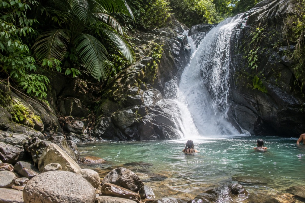
Every one of the genuine swimming spots carries the same warning, and it is not boilerplate. Flash floods can occur throughout the year and are more frequent in the rainy months of April and May, and the Forest Service warns that a sudden surge can claim victims in less than one minute, with flood water capable of reaching 30 feet or more. If you are heading to a river on your own, the Río Mameyes has a live USGS gauge near Sabana that publishes real-time discharge and gage height, so you can check whether the river is running high before you get in. Our longer piece on whether you can swim at El Yunque walks through each spot in detail.
| Site | Swimming listed by Forest Service | Access notes |
|---|---|---|
| Juan Diego Falls | Yes, wading pool | PR-191 km 9.6, 30-minute parking maximum |
| Angelito Trail / Río Mameyes | Yes, Las Damas Pool | Road 988 km 3.6, easy 0.4 km trail |
| Puente Roto | Yes | Road 988, road under construction, drive carefully |
| Quebrada Grande | Yes | Poor road conditions posted |
| Quebrada Sonadora | Yes | Listed water activities |
| Río Espíritu Santo Observation Point | Yes | Road 186, El Toro Scenic Byway |
| Río Sabana Recreation Area | Yes | Naguabo side of the forest |
| Baño Grande | No | Closed to swimmers since 1968 |
| La Coca Falls | No | Roadside viewing stop |
How Do The Two La Mina Approaches Compare?
The La Mina Trail is the shorter but harder approach, 0.7 miles with 492 feet of elevation change and concrete stairs rated challenging, while Big Tree is longer but gentler at 0.9 miles and 164 feet over asphalt, rated moderate. Both were built by the Civilian Conservation Corps, both end at the same falls, and both are currently in the closed set.
The comparison is worth knowing even while the trails are shut, because it tells you what the experience will demand if and when they reopen, and because the same trade-off shapes every waterfall hike in the forest. La Mina's stairs are the tax you pay for the direct route; the Forest Service's own description warns the return trip is arduous. Big Tree trades a longer walk for shade from the Tabonuco canopy and a gentler grade, which is why it was traditionally the family option. Neither is a wilderness route: both date from the 1930s and 1940s construction era, with shelters and paving built in.
| Trail | Length | Elevation change | Difficulty | Surface | Trailhead |
|---|---|---|---|---|---|
| La Mina Trail | 0.7 mi (1.1 km) | 492 ft / 150 m | Challenging | Concrete stairs, dirt | PR-191 km 12.2, Palo Colorado |
| Big Tree Trail | 0.9 mi (1.4 km) | 164 ft / 50 m | Moderate | Asphalt throughout | PR-191 km 10.4 |
If you are planning hikes around the rest of the forest while these two wait, the open network still has range. Mount Britton Trail is 1.3 km with 591 feet of climbing to a 1937 stone tower at 3,087 feet, rated challenging. The El Yunque Trail is 2.6 miles with 1,378 feet of elevation change, though its status is partial, with the Forest Service describing access as far as Los Picachos. The El Toro Trail on the Naguabo side is 2.3 miles and difficult, climbing to El Toro Peak at 3,524 feet, the highest point in the forest. Our El Yunque hiking trails guide maps all of it, with the reminder that trail status is the thing to verify the week you go.
What Are The Best Waterfall Alternatives While The Status Holds?
The strongest alternatives are the river-pool and slide experiences on the open network: Las Tinajas and Charco Frío with a small group, the Río Espíritu Santo on a hidden-waterfall hike, or a guided waterfall day with transport from San Juan. Each replaces the La Mina payoff, a short walk to swimmable water, without depending on a closed trail.
The Small-Group Waterfall & Waterslides tour covered above is the most direct swap, since its confirmed stops at Las Tinajas and Charco Frío deliver exactly what people went to La Mina for: a guided walk to mountain water you can get into. For a longer day with transport handled, the El Yunque Rainforest and Waterfall Guided Tour runs 8 hours from $72, rated 4.8 across 1,209 reviews, with hotel pickup and free cancellation, and its San Juan pickup point makes it the easiest fit for cruise and hotel-based travelers who cannot drive themselves.
For travelers who want the quieter version, the Hidden Off The Path Waterfall Hike with Transport goes to the Río Espíritu Santo, one of the Forest Service's own listed swimming waters, on a 5-hour trip from $115 rated 4.7 across 34 reviews. The small review count is worth reading as a signal of a smaller operation rather than a quality verdict, and the free-cancellation policy gives you room to rebook if the forecast turns.
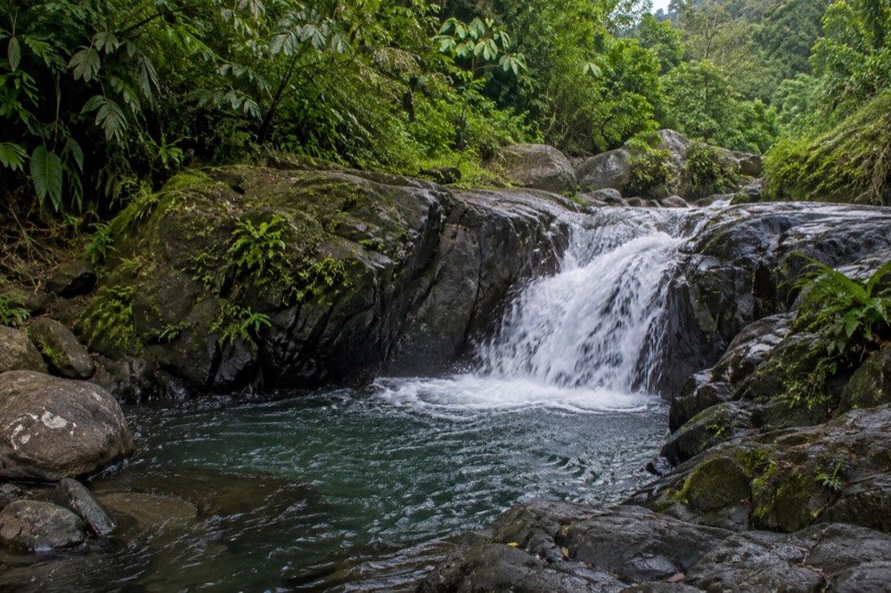
Closer to the PR-191 corridor itself, the Juan Diego Falls and Angelito Trail pairing is the nearest thing to the old La Mina experience on Forest Service land: a short walk to a natural pool with a waterfall you can wade into, with a 30-minute parking cap at Juan Diego and an easy 0.4 km trail down to the Río Mameyes from Road 988. Our Juan Diego Falls and Angelito Trail guide covers both, including the flash-flood cautions that apply to every river stop in the forest.
How Should You Plan A Trip Around A Status That Changes?
Plan the booking, not the waterfall: pick a tour with free cancellation and a confirmed-stops list that names open water, verify the trail status alert in your travel week, and keep a backup from the Forest Service's listed swimming sites. The forest itself needs no reservation and charges nothing at the corridor.
The practical sequence looks like this. Check the alerts page the week you travel, since trail and site closures in El Yunque change with construction and storm damage. Book a tour whose water stops are named and open, favoring listings with free cancellation so a status change or a stormy forecast costs you nothing. If you are driving yourself, remember that parking is the real constraint: it is permitted only in designated areas, ticketed at La Coca Falls, and capped at 30 minutes at Yokahú Tower and Juan Diego. Rideshare apps cannot pick you up at the corridor or El Portal, and not every taxi holds a forest permit, so a self-driver without a car has limited exits.
| Planning step | What to do | Why it matters |
|---|---|---|
| Verify trail status | Read the Forest Service alerts page in your travel week | Closures change with construction; no page is a standing promise |
| Choose the tour | Read the confirmed stops; treat any La Mina mention as stale copy | Both approaches to the falls are in the closed set |
| Protect the booking | Prefer listings with free cancellation | Status and weather can shift after you book |
| Check the river | Use the USGS Río Mameyes gauge before swimming | Flash floods can surge in under a minute |
| Get there early | Arrive well before midday | Parking fills; capacity is managed all day |
The footwear point is the Forest Service's own and it leads its safety advice: wear good shoes with traction, because it is a rainforest, it is wet and mossy, and wet surfaces on a slope are a hazard. That advice holds on every trail in this article, open or closed. For what to pack beyond shoes, our what to wear and bring guide has the full list, and this site, El Yunque National Forest Tours, tracks the roster listings against the official pages so the recommendations stay honest.
Whether you end up at a river pool on the Río Mameyes, sliding at Las Tinajas, or simply watching La Coca Falls from the roadside, the same three tours below cover the widest range of budgets and formats for a waterfall day in and around the forest.
Common Questions About La Mina Falls
Is La Mina Falls open?
The Forest Service's FAQ says the La Mina trail and falls remain closed for construction, and the forest trails status alert lists both La Mina Trail and Big Tree Trail, the two approaches, as closed. Check the official alerts page in the week you travel, since these statuses change with construction progress.
Can you swim at La Mina Falls?
Not currently. Swimming at the falls appears only in the Big Tree Trail description, and that trail is in the closed set. The swimming sites the Forest Service lists today include Juan Diego Falls, the Angelito Trail pools on the Río Mameyes, Puente Roto, Quebrada Grande, Quebrada Sonadora, the Río Espíritu Santo observation point and the Río Sabana area, all with flash-flood warnings.
How long is the hike to La Mina Falls?
The La Mina Trail is 0.7 miles one way with 492 feet of elevation change, rated challenging for its winding concrete stairs. The Big Tree Trail is 0.9 miles with 164 feet of change over asphalt, rated moderate. Both figures come from the Forest Service trail pages and describe the routes as built.
Why do tours still mention La Mina Falls?
Because their copy predates the closure. A listing that promises La Mina as a stop, or promises swimming there, is repeating pre-closure marketing. Read the confirmed stops on the listing instead: the tours that name open water, such as Las Tinajas, Charco Frío or the Río Mameyes, are the ones delivering what the listing says.
What is the best alternative to La Mina Falls?
On Forest Service land, Juan Diego Falls and the Angelito Trail on the Río Mameyes are the closest match: a short walk to a natural pool with a waterfall. With a tour, the small-group waterfall and waterslides trips to Las Tinajas and Charco Frío replace the La Mina payoff most directly.
Do you need a reservation to enter El Yunque?
No. Entrance to the PR-191 North recreational corridor is free and requires no reservation, with hours from 8:00 a.m. to 5:00 p.m. The only thing that charges is El Portal Visitor Center, at $8 for visitors 16 and over, free under 15. Capacity is managed through designated parking, which is why arriving early matters.