El Yunque Hiking Trails: A Trail-By-Trail Guide With The Tours That Walk Them
El Yunque's trails range from a 0.4 km riverside walk to a 4.6 mile route the Forest Service itself calls very challenging, and the trail you pick decides most of your day. Here is what each one involves, which are realistic for a half-day visit, and which tours put boots on them.
Short answer
El Yunque National Forest has roughly a dozen named hiking trails, from the 0.4 km Angelito Trail to the 4.6 mile Tradewinds Trail. Entry is free, no reservation is required, and hours are 8:00 a.m. to 5:00 p.m. The practical constraints are parking, weather and trail closures, so check the Forest Service alerts page before choosing your route.
El Yunque National Forest packs an unusual amount of hiking into 28,516 acres. It is the only tropical rainforest within the national forest system, it spans eight municipalities in northeastern Puerto Rico, and its trail network was largely carved out by the Civilian Conservation Corps in the 1930s and 1940s. Some of those stone stairways and masonry towers are still the infrastructure you walk on today.
What makes planning a hike here different from most forests is that the trail list and the tour list overlap heavily. A reader picking a trail is often, in practice, picking a tour, because transport, parking and permitted pick-up are the hard parts of the day. This guide walks through every major trail with its verified length, elevation change and difficulty, then maps each one to the guided tours that actually walk it.
Before anything else, one fact that most third-party pages still get wrong: entrance to the PR-191 North recreational corridor is free and no reservations are required. Operating hours are 8:00 a.m. to 5:00 p.m. There is no timed-entry pass to buy and nothing for a tour operator to skip past. The Forest Service manages capacity through parking, which is permitted only in designated areas. If you want the full picture on that, our El Yunque National Forest Tours homepage breaks down access, fees and the honest case for booking a guide.
What Are The Best Hiking Trails In El Yunque?
The best trail depends on what you want from the day: the Angelito Trail is the easiest riverside walk at 0.4 km one way, Mount Britton delivers a stone tower at 3,087 feet after a challenging 1.3 km climb, and El Toro is the serious hike at 2.3 miles to the forest's highest peak at 3,524 feet. Most visitors with a half day choose Angelito or Mount Britton.
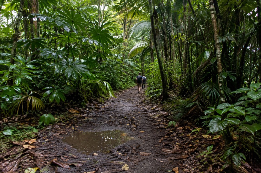
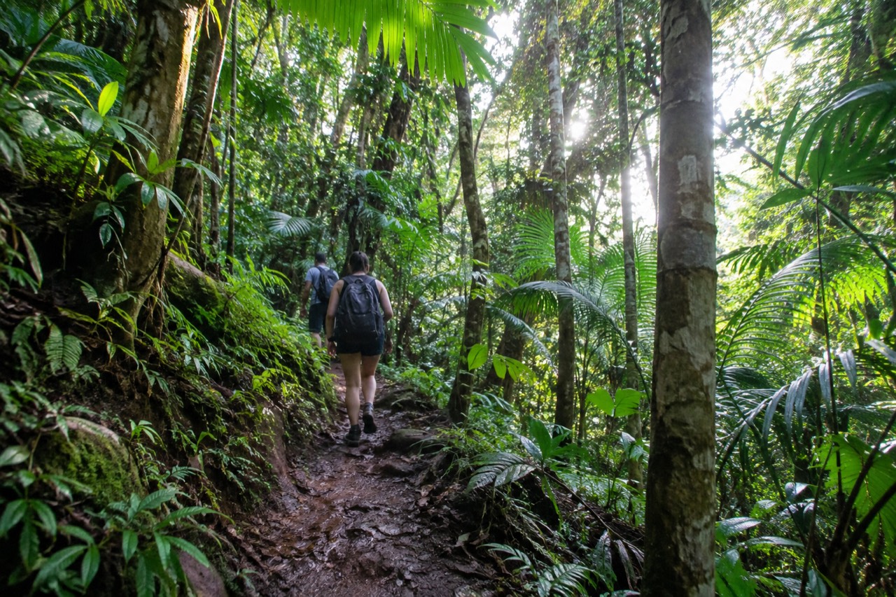
There is no single "best" trail because the forest splits into experiences rather than a ladder of quality. The short walks near the road, Angelito and the El Portal interpretive loop, suit families and anyone with limited mobility or limited time. The mid-length climbs, Mount Britton and the Baño de Oro Trail, reward you with either a panoramic tower or a restored National Historic Property built by the CCC in the mid-1930s. The long routes, El Yunque Trail, El Toro Trail and Tradewinds Trail, are half-day commitments with real elevation.
Rain shapes the choice as much as fitness does. Annual rainfall in the Luquillo Experimental Forest ranges from about 96 inches at lower elevations to over 157 inches at higher stations, and the Forest Service's own safety advice leads with footwear: "Wear good shoes with traction: it is a rainforest, and it is wet and mossy. Wet surfaces can be a hazard and even more so if it's on a slope." A trail that reads as easy in dry conditions becomes a different proposition on wet stone steps.
Flash flooding is the other constant. The Forest Service warns that flash floods can occur throughout the year and are more frequent in the rainy months of April and May, and that a sudden surge can claim victims in less than one minute. Any trail that descends to a river, which includes Angelito, Bisley and La Coca, carries the standing advice to stay alert for heavy rain upstream, not just where you are standing. Our guide to hiking El Yunque in the rain covers how to read the forecast and what a guide does about it.
Which El Yunque Trails Are Open Right Now?
Trail status in El Yunque changes with construction and storm recovery, so no trail's status should be treated as permanent: the Forest Service publishes a Forest trails status alert, and that page is the authority to check the week you visit. Lengths and difficulty below are stable facts; open or closed is a moving target.
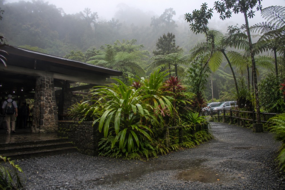
The verified trail inventory looks like this. Lengths and difficulty ratings come straight from the individual Forest Service trail pages.
| Trail | Length | Elevation change | Difficulty |
|---|---|---|---|
| El Portal Trail | 0.3 mi (0.5 km) | 66 ft / 20 m | Easy interpretive loop |
| Angelito Trail | 0.4 km one way | 132 ft / 40 m | Easy |
| Caimitillo Trail | 0.4 mi (0.6 km) | Not published | Easy |
| Baño de Oro Trail | 0.5 km one way | 230 ft / 70 m | Easy to moderate |
| La Mina Trail | 0.7 mi (1.1 km) | 492 ft / 150 m | Challenging |
| Big Tree Trail | 0.9 mi (1.4 km) | 164 ft / 50 m | Moderate |
| La Coca Trail | 1.8 mi (2.9 km) one way | 656 ft / 200 m | Very challenging |
| Mt. Britton Trail | 1.3 km | 591 ft / 180 m | Challenging |
| El Toro Trail | 2.3 mi (3.8 km) | 1,325 ft / 404 m | Difficult |
| El Yunque Trail | 2.6 mi (4.2 km) | 1,378 ft / 420 m | Challenging |
| Río Sabana Trail | 2.9 mi (4.7 km) | 1,168 ft / 356 m | Challenging |
| Bisley Trail | 3 mi | Not published | Moderate |
| Tradewinds Trail | 4.6 mi (7.4 km) | 1,096 ft / 334 m | Very challenging |
Two cautions on reading that table. First, several of these trails have carried closures tied to hurricane recovery and construction work, and the Forest Service's FAQ states plainly that damage from Hurricanes Irma and María around the entire forest was significant and recovery continues. Second, some statuses conflict between pages, which is exactly why this site routes you to the live alert rather than printing a status. Check the Forest trails status alert and the wider El Yunque alerts index before you finalize a route.
This volatility is also the strongest honest argument for a guide. An operator who works in the forest weekly knows which trailheads are actually reachable on the day, and a permitted vehicle with a legal drop-off solves the parking problem that the Forest Service cites as its reason for managing capacity. Rideshare apps cannot pick up at the recreational corridor or El Portal, so a self-driver arriving without a car has no easy exit either. If you are weighing that trade-off, start with these three options.
What Do You See On The Angelito Trail And The Río Mameyes?
The Angelito Trail is a 0.4 km one-way descent through Tabonuco forest to the Río Mameyes, a federally designated Wild and Scenic River, ending at Las Damas Pool and other swimming spots. It is the shortest real hike in the forest and the one most often recommended for families with younger children.
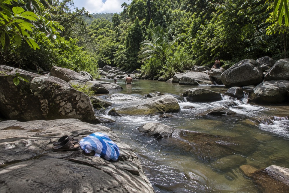
The Forest Service describes the trail as descending through Tabonuco trees in the lower montane forest to the river, with the roar of the rushing water pulling you onward to Las Damas Pool. Swimming is a listed water activity here, which matters because very few places in the forest carry that listing. The trail sits on Road 988, the Luquillo entrance, at km 3.6, which also makes it one of the few hikes reachable from the Luquillo side rather than the main PR-191 corridor.
The Río Mameyes deserves respect as much as enjoyment. It has a live USGS stream gauge (site 50065500, Rio Mameyes near Sabana) publishing real-time discharge and gage height, so you can literally check the river before you get in. The Forest Service repeats the same warning on this trail as on Bisley: flash flooding along El Yunque's rivers can happen unexpectedly, so be aware of current conditions and flash flood reports for the area.
Several tours on our roster build their day around this river. The Half-Day Waterslide Adventure from $94.78 lists Río Mameyes as a confirmed stop, and the Small-Group Beach Day tour from $65 confirms Río Mameyes alongside Luquillo Beach and the Luquillo Kiosks. If swimming is the goal rather than a by-product, read our piece on swimming at El Yunque first, because the list of legal swimming spots is shorter than most visitors expect.
For hikers who want the river plus a full day, the Hike and Kayak Bio Bay Combo confirms Las Tinajas as a stop and pairs the forest with a night paddle on Laguna Grande, the bioluminescent bay in Fajardo. It runs 12 hours from $179.65 with free cancellation, which is the practical way to see a glowing bay and still get a trail in on the same itinerary.
Can You Hike To A Waterfall In El Yunque?
The famous waterfall hikes, La Mina Trail and Big Tree Trail, both of which end at La Mina Falls, have carried closures for construction and hurricane recovery, so a waterfall hike today usually means Juan Diego Falls on PR-191 or river pools like Las Tinajas on the Luquillo side. Check the trails status alert before planning around any specific fall.

La Mina Falls is the waterfall most travel content photographs, and it is also the one this site is most careful about. Both approaches, the 0.7 mile La Mina Trail and the 0.9 mile Big Tree Trail, have been closed while recovery work continues, and the Forest Service FAQ says the same. We do not print a reopening promise because none exists in an official source. What we can say is what the trails are like when open: La Mina is rated challenging for its winding concrete stairs, Big Tree moderate and paved, and both start from the PR-191 corridor around km 10 to 12.
Juan Diego Falls is the in-forest alternative that is a verified swimming site. The Forest Service describes a short path to a natural pool along Juan Diego Creek with a waterfall you can wade into, at PR-191 km 9.6, with a 30-minute parking maximum because of limited capacity. The nearby roadside falls, La Coca, drops 85 feet onto rocks at the base and is explicitly a viewing stop: swimming is not a listed recreation opportunity there.
The Luquillo side carries the waterfall experiences most tours actually sell. Las Tinajas and Charco Frío appear as confirmed stops on multiple tours, and the Small-Group Waterfall and Waterslides tour from $63 confirms both. One structural honesty note that changes what you are buying: the natural waterslides at Las Paylas sit on private land in Luquillo, outside the national forest boundary, with no Forest Service oversight. A tour that includes them is including something outside the forest, and our Luquillo waterslides guide explains the full picture.
For a hiker who wants waterfalls with a guide and transport, the 8-Hour Waterfall Hike is the dedicated option, from $72 with hotel pickup and free cancellation.
How Hard Are The Big Hikes: Mount Britton, El Yunque Peak And El Toro?
Mount Britton Trail is 1.3 km with 591 feet of climbing to a CCC stone tower at 3,087 feet, El Yunque Trail is 2.6 miles with 1,378 feet of gain, and El Toro Trail is 2.3 miles with 1,325 feet of gain to the forest's highest peak at 3,524 feet. All three are rated challenging or difficult.
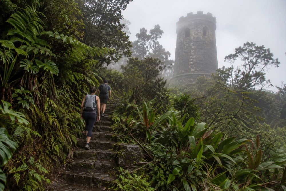
Mount Britton is the most rewarding climb per minute. The tower was built by the Civilian Conservation Corps in the late 1930s and is described by the Forest Service as the tallest of the CCC towers with stone masonry; on a clear day the deck shows the Atlantic, the Caribbean and the eastern coastal plain. The trailhead is on the one-way loop road PR-9938 off the upper end of PR-191 near km 13, and the route crosses two mountain streams. The Mount Britton Spur Trail, at 850 to 900 meters elevation, is a separate open access route.
El Yunque Peak is the summit most people picture, but its trail has a complicated status: the El Yunque Peak Trail has been open only as far as Los Picachos, a CCC stone platform at 3,175 feet with a 360-degree view, with the section from the Los Picachos spur to the peak itself closed for safety reasons after damage to a retaining wall. Los Picachos alone is a legitimate destination and often the practical turnaround point.
El Toro is the summit for serious hikers. The trail runs 2.3 miles from Road 186, the El Toro Scenic Byway on the Naguabo side, taking roughly three hours to the peak. The area was designated a National Wilderness Area in 2005 and is the only tropical wilderness in the U.S. National Forest System. The Forest Service lists habitat here for the endangered Elfin Woods Warbler, the Puerto Rican Parrot, the Puerto Rican Boa and five species of coquís. Access note: the byway carries a current condition of poor road conditions, drive carefully.
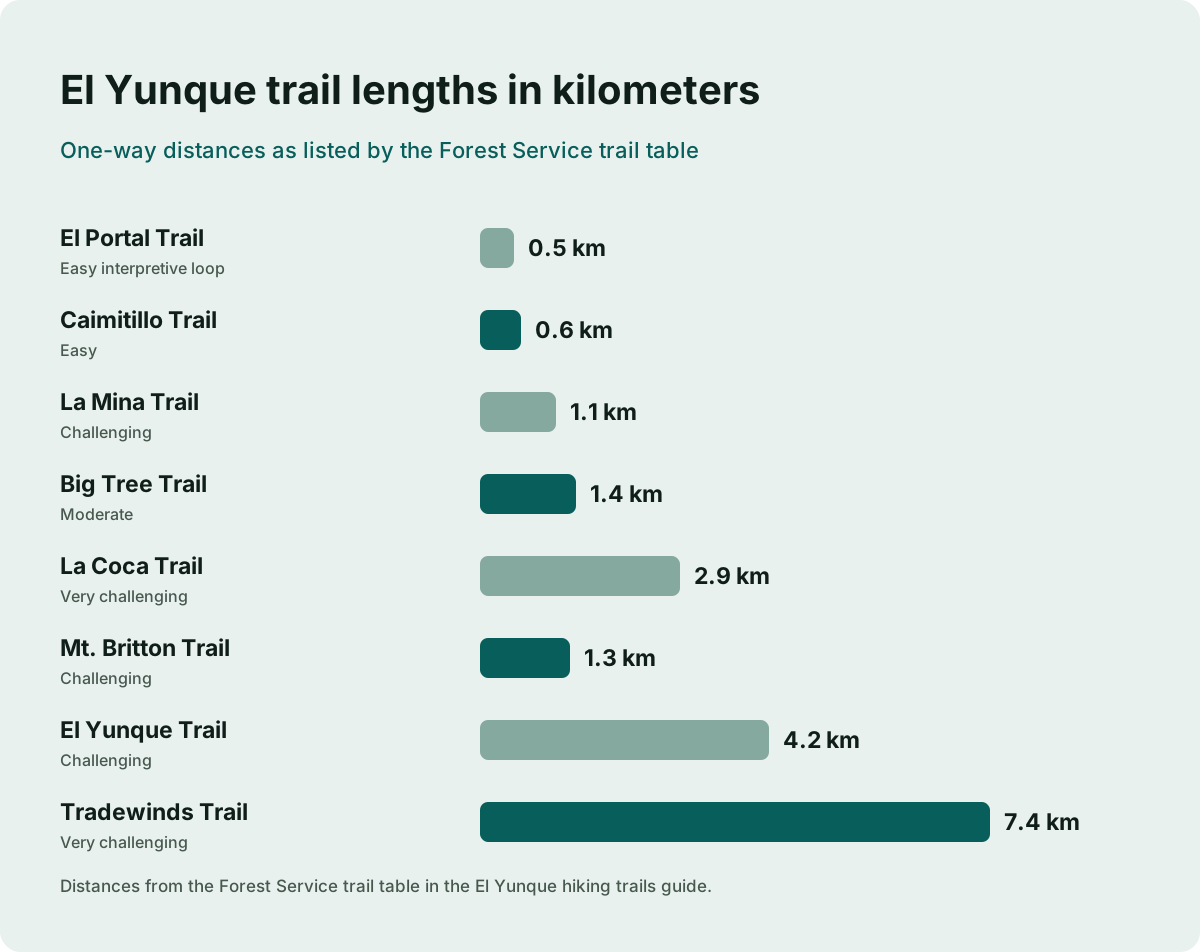
La Coca Trail deserves a mention as the one the Forest Service flags hardest: at 1.8 miles one way with 656 feet of gain it is rated very challenging, and the trail page notes it is one of the trails where the agency loses the most people. Tradewinds Trail, 4.6 miles and also rated very challenging, is the longest route in the forest. If difficulty is your main question, our piece on whether El Yunque is a difficult hike works through the fitness question trail by trail.
What Should You Wear And Bring On An El Yunque Hike?
Wear shoes with real traction and clothes that handle rain, because this forest receives roughly 96 to 157 inches of rain a year depending on elevation, and wet stone steps are the main hazard on nearly every trail. Bring water, a dry bag for electronics and nothing you would mind carrying back out.
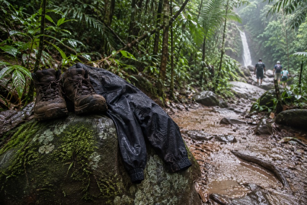
The Forest Service's own preparation advice puts traction footwear first, and it is worth taking literally. The masonry stairs on Mount Britton and the paved sections of other trails grow moss and algae that stay slick even when the rain has stopped. Water shoes earn their place on any river trail, and we cover that question in detail in what to wear and bring to El Yunque.
Timing matters as much as gear. The corridor opens at 8:00 a.m. and closes at 5:00 p.m. sharp, with the Forest Service advising visitors to begin exiting at least 15 minutes before closing. Parking maximums bite at the popular spots: 30 minutes at Yokahú Tower and 30 minutes at Juan Diego. Arriving early is the standard advice, and our morning versus afternoon comparison tests whether it actually holds.
The access rules that shape a hiking day are few, but each one decides something about your plan. This is the full set.
| Access rule | What it means for a hiker |
|---|---|
| Corridor hours, 8:00 a.m. to 5:00 p.m. | Start early; begin exiting by 4:45 p.m. |
| No reservation, free entry | Nothing to book for the trails themselves |
| Designated parking only, ticketed at La Coca | Arrive early for popular trailhead lots |
| 30-minute parking maximum at Yokahú and Juan Diego | These are photo and wade stops, not base camps |
| Rideshare cannot pick up in the corridor | Plan your exit before you enter |
| El Portal fee, $8 for 16 and over | Only charged at the visitor center, not the trails |
Do You Need A Guide For El Yunque Hiking Trails?
You do not need a guide to hike El Yunque: entry is free, no reservation exists and the trails are public. What a guide buys is a permitted vehicle with a legal drop-off, someone else solving the parking constraint, and current knowledge of which trails are actually open on the day.
The transport problem is the part solo visitors underestimate. The Forest Service maintains a public directory of authorized and permitted tour operators, and it warns that not every taxi driver holds a forest permit, so visitors should ask before hiring any transportation service. Rideshare is worse than useless as an exit: the corridor and El Portal are not pick-up points for rideshare apps, and the agency's alert describes visitors being forced to walk long distances to reach a valid pick-up point. If you drove a rental in, none of this binds you; if you did not, it shapes the whole day.
The knowledge problem is the second half. Trail status here changes with construction and storm recovery, and the difference between a planned route and a workable one is often a single alert a visitor never saw. A guide who walked the forest this week makes that call before you burn the drive. The dedicated hiking tours on the roster make the case plainly: the 8-Hour Hiking Adventure from $103.44 with hotel pickup, the 6-Hour Hike with Transport from $125, and the Hidden Waterfall Hike from $115, which confirms a stop at the Río Espíritu Santo.
For visitors who want the forest and the bioluminescent bay in a single day, the Two-in-One Day Trip from $183.98 pairs El Yunque with Laguna Grande in Fajardo over 12 hours, with hotel pickup and free cancellation, and confirms Río Mameyes as a stop.
One honest note on the bio bay half of any combo: in 2025, sargassum inundated Laguna Grande, and as it decomposed it stripped the lagoon of oxygen and killed the dinoflagellates that produce the glow, leaving the bay dark for several months. Consistent marine bioluminescence occurs in only five places in the world and Puerto Rico holds three of them, but that also means the phenomenon is genuinely fragile. A combo tour is a bet on both halves of the day, and free cancellation is worth having for exactly that reason.
Which Tour Should You Pick For Each Trail?
Match the tour to the trail you actually want to walk: riverside and swimming tours center on the Río Mameyes and Angelito side, waterfall tours target Las Tinajas and Juan Diego, and the long hiking tours cover the Mount Britton and El Yunque Trail climbs. Here is the mapping from trail to tour.
| Trail or area | Tours that walk it | From (per person) |
|---|---|---|
| Angelito Trail / Río Mameyes | Half-Day Waterslide Adventure; Small-Group Beach Day; Slides and Beach, Pickup | $94.78; $65; $44 |
| Las Tinajas / Charco Frío | Small-Group Waterfall and Waterslides; Hike and Kayak Bio Bay Combo | $63; $179.65 |
| Mount Britton / corridor hikes | 8-Hour Hiking Adventure; 6-Hour Hike with Transport; Hidden Waterfall Hike | $103.44; $125; $115 |
| Night walk | Nighttime Nature Walk (Angelito Trail) | $75 |
| Río Espíritu Santo | Hidden Off The Path Waterfall Hike | $115 |
Two entries deserve a flag. The Nighttime Nature Walk is the only tour on the roster that confirms the Angelito Trail by name, at 2 hours 30 minutes from $75, and it is a genuinely different way to see the forest: coquís after dark. And the Hidden Off The Path Waterfall Hike confirms the Río Espíritu Santo Observation Point, one of the Forest Service's own listed swimming sites, which is a rarer itinerary than the Luquillo-side standard.
The Hike and Kayak Bio Bay Combo remains the strongest single pick for a visitor who wants a real trail and only has one full day, because it stacks Las Tinajas, a 12-hour window and the Laguna Grande paddle into one booking from $179.65 with free cancellation.
Whichever way you go, three planning rules hold. Check the Forest Service current conditions page for corridor hours and parking rules before you drive. Wear shoes with traction, because the Forest Service says so and the moss agrees. And treat every closure you read anywhere, including here, as provisional until you have seen it on the alerts page the week you travel.
Common Questions About El Yunque Hiking Trails
What is the easiest hiking trail in El Yunque?
The Angelito Trail, at 0.4 km one way with 132 feet of elevation change and an Easy rating, is the shortest real hike in the forest, descending to the Río Mameyes. The El Portal Trail interpretive loop, 0.3 miles with a packed gravel surface, is even gentler and partially accessible.
What is the hardest hiking trail in El Yunque?
The Tradewinds Trail, 4.6 miles with 1,096 feet of elevation change, is rated very challenging and is the longest route in the forest. La Coca Trail, 1.8 miles one way with 656 feet of gain, is also rated very challenging, and the Forest Service notes it is one of the trails where it loses the most visitors.
Do you need a reservation to hike El Yunque trails?
No. Entrance to the PR-191 North recreational corridor is free and no reservations are required, with operating hours of 8:00 a.m. to 5:00 p.m. Capacity is managed through designated parking only. The only fee site is El Portal Rainforest Center, at $8 for visitors 16 and over.
Can you hike to La Mina Falls?
Both trails to La Mina Falls, La Mina Trail and Big Tree Trail, have carried closures tied to construction and hurricane recovery, and the Forest Service FAQ says the trail and falls remain closed for construction. Check the Forest trails status alert for the current week, and consider Juan Diego Falls or the Luquillo-side river spots as alternatives.
Is a guided tour worth it for El Yunque hiking?
A tour does not buy special entry, because there is no reservation to skip. It buys a permitted vehicle with a legal drop-off, a solution to the parking constraint, and a guide who knows which trails are actually open that day, which matters more here than at most forests. Tours with hotel pickup start from $63 on our roster.
What should you wear hiking in El Yunque?
Shoes with traction, first and foremost: the Forest Service's own advice is that the forest is wet and mossy and wet surfaces on a slope are a hazard. Add quick-drying clothes, a rain layer, water shoes for river trails, and a dry bag, since rainfall runs from roughly 96 inches a year at lower elevations to over 157 inches higher up.