What Is El Yunque In Puerto Rico?
El Yunque is the only tropical rainforest within the national forest system, a 28,516-acre USDA Forest Service forest on Puerto Rico's east side. Here is what it actually is, and what you can do there.
What Is El Yunque In Puerto Rico?
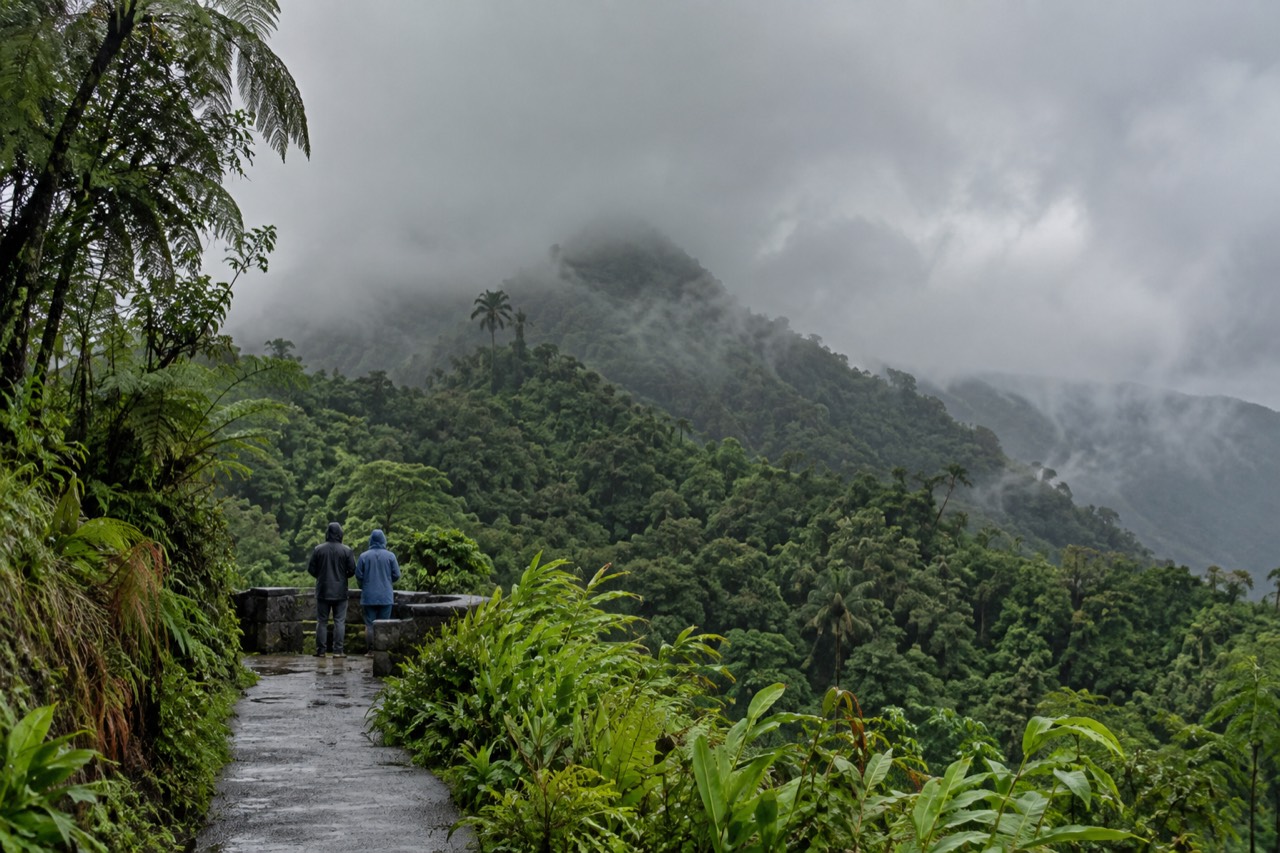
El Yunque is a tropical rainforest covering 28,516 acres (11,540 hectares) across eight municipalities in northeastern Puerto Rico, managed by the USDA Forest Service as a National Forest. It is the only tropical rainforest within the national forest system, entry is free, and no reservation is required for the main recreational corridor. Most first-time visitors arrive expecting something like a Caribbean national park with a gate and a ticket booth. What they find instead is a working national forest threaded by a single mountain road, PR-191 North, where the constraint is not admission but parking, and where the Forest Service manages capacity by turning cars away when the lots fill. The forest is named after Yuquiyú, the good spirit of the mountains in Taíno tradition, and the name now attaches to the peak, the forest, and the wider region more or less interchangeably in everyday Puerto Rican usage.
Understanding what El Yunque is starts with what it is not. It is not a national park, it has no connection to the National Park Service, and there is no "El Yunque National Park." It is a unit of the National Forest System, the same federal network that holds places like the Tongass in Alaska, and it is run by the United States Department of Agriculture's Forest Service. That distinction is not trivia. It explains why the signage, the alerts, the fee structure and the whole feel of the place follow Forest Service conventions rather than park conventions, and why the interagency annual, senior, military and access passes are honored at the El Portal visitor center but there is no forest-wide entrance pass of any kind.
The forest extends through Río Grande, Luquillo, Canóvanas, Fajardo, Naguabo, Ceiba, Las Piedras and Juncos, with the bulk of the visitor infrastructure concentrated on the Río Grande side, closest to San Juan. The Forest Service describes it as "one of the smallest in size, yet one of the most biologically diverse" forests in the system. Within that compact area the land climbs from lower-elevation tabonuco forest through palo colorado and palm forest to dwarf cloud forest near the summits, and the highest peak, El Toro, reaches 3,524 feet. Rainfall follows the same gradient: the Forest Service's own research institute measured annual totals ranging from roughly 2,450 mm at lower stations to over 4,000 mm at the higher ones, with the single wettest station, at El Yunque Peak, recording 4,300 mm in a year.
For a reader still deciding whether to come, the practical summary is this: El Yunque is a half-day to full-day destination, reached by road from the San Juan area, where you drive or are driven up a mountain corridor past waterfalls and stone towers, walk short-to-moderate trails, and possibly get into a river. It is not a multi-day backcountry destination, and it is not a beach, though the famous Luquillo beach and kiosks sit at its eastern foot and pair naturally with it. If that sounds like your day, the pages on El Yunque National Forest Tours cover each piece in depth, and the tours below are a good first look at how a guided day is shaped.
Who Manages El Yunque, And What Does That Mean For Visitors?
El Yunque is managed by the USDA Forest Service, with a supervisor's office in Río Grande, and that management shows up for visitors in three concrete ways: free corridor entry, Forest Service alerts and trail-status pages, and a permit system for commercial operators. The forest supervisor is Keenan Adams, and the Forest Service presence on the ground is visible at the El Portal Rainforest Center, at the Palo Colorado information point, and in the construction projects that have reshaped parts of the corridor since the 2017 hurricanes. The Forest Service publishes a public directory of authorized and permitted tour operators, which is the official list of who is allowed to guide commercially inside the forest. Not every taxi holds a forest permit, and the Forest Service explicitly tells visitors to ask before hiring any transportation service.
The management structure matters because it drives the site's single most useful planning fact. Entrance to the PR-191 North recreational corridor in Río Grande is free and no reservations are required, with operating hours of 8:00 a.m. to 5:00 p.m. The old timed-entry reservation system that once ran through the federal recreation booking site no longer exists; the facility behind it has been retired, and the only bookable federal product left for El Yunque is the El Portal visitor center ticket. All four access corridors, PR-191 North, PR-191 South near Naguabo, PR-988 through Luquillo and PR-186 along the El Toro Scenic Byway, are published as not requiring a reservation. Capacity is managed through parking: parking is permitted only in designated areas, and at popular stops like Yokahú Tower and Juan Diego Falls the limit is 30 minutes per vehicle.
One fee does exist, and it is worth being precise about it. El Portal de El Yunque Rainforest Center, the visitor center at kilometer 4.1 on PR-191, charges $8 for visitors 16 and over, admits children under 15 free, and charges $4 for interagency pass holders. That is a visitor-center fee, not a forest entry fee. A separate proposal to add a $4 per-person La Mina Recreation Area fee is exactly that, a proposal; the public comment period closed in August 2026 and no decision has been published, so La Mina is free today and should not be described otherwise. The details, and the honest answer on whether you need to book anything at all, are laid out in El Yunque tickets and reservations.
If you are weighing a guided day against driving yourself, the honest case for a tour here is not queue-skipping, because there is no queue to skip. It is transport and parking. Rideshare apps cannot legally pick up at the recreational corridor or El Portal, the Forest Service warns that visitors relying on them have been forced to walk long distances to a valid pick-up point, and not every cab driver holds a forest permit. A permitted tour vehicle with a legal drop-off solves the parking problem and comes with a guide who knows which trails are actually open on the day, which in a forest still recovering from 2017 storm damage is worth more than usual.
How Big Is El Yunque, And What Does The Landscape Look Like?
El Yunque covers 28,516 acres, about 11,540 hectares, which the Forest Service rounds to "nearly 29,000 acres," making it one of the smallest national forests in the system yet one of the most biologically diverse. The terrain is steep and compact, rising from the coastal plain to El Toro Peak at 3,524 feet, and the drive up the main road passes through visibly different forest types in under half an hour. The number worth ignoring is the larger figure that sometimes circulates online: 55,812 acres is the administrative proclamation boundary, which includes private inholdings, and is not the size of the national forest itself. Within the true boundary the land climbs quickly, with Los Picachos at 3,175 feet and the Mount Britton tower at 3,087 feet along the way.
The lower slopes hold tabonuco forest, dominated by tall trees in the same family as mahogany. Higher up, the palo colorado forest takes over, then Sierra palm, and near the summits the trees shrink into stunted, moss-covered dwarf cloud forest, where everything is draped in epiphytes and the cloud deck sits on the ridgeline. The El Toro Wilderness, designated in 2005, protects a roadless chunk of the southern side and is the only tropical wilderness in the U.S. National Forest System. Its habitat list from the Forest Service includes the endangered Puerto Rican parrot, the Puerto Rican boa, five species of coquí, the tiny frogs whose night chorus is the forest's signature sound, and the orchid Lepanthes eltoroensis, which grows nowhere else on earth in the wild.
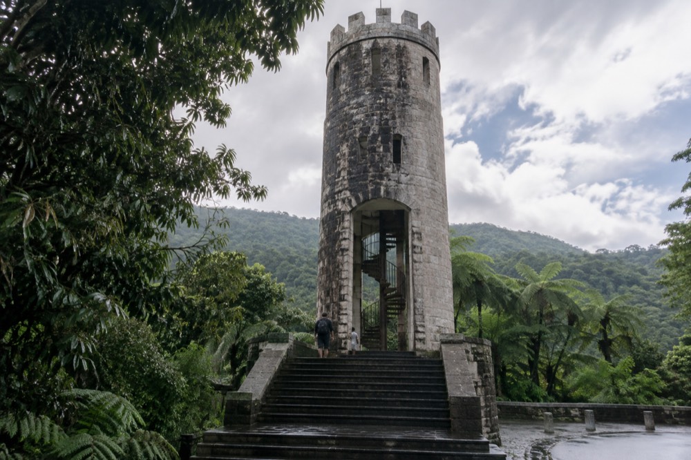
The human layer is older than the federal designation. The Civilian Conservation Corps built much of the road, the stone towers and the picnic shelters in the 1930s and 1940s, and that masonry is now part of the character of the place: Yokahú Tower, a 69-foot stone observation tower built in the early 1960s by Dr. Frank H. Wadsworth, a former forest supervisor, and the Mount Britton tower, built by the CCC in 1937-38, both reward the climb with views over the canopy to the Atlantic on clear days. Baño Grande, a stone-dammed pool 18 feet deep built by the CCC in the late 1930s and closed to swimmers since 1968, and Baño de Oro, a former swimming hole from the same era and now a registered National Historic Property, sit along the upper corridor as historic photo stops rather than swimming destinations.
| Feature | Figure | Note |
|---|---|---|
| Forest size | 28,516 acres (11,540 ha) | "Nearly 29,000 acres" in Forest Service rounding |
| Highest peak | El Toro, 3,524 feet | Namesake of the El Toro Wilderness, designated 2005 |
| Other high points | Los Picachos 3,175 ft; Mount Britton tower 3,087 ft | Both reachable on foot from the upper corridor |
| Annual rainfall | ~2,450 mm low elevations to 4,000+ mm high | Wettest station, El Yunque Peak, recorded 4,300 mm |
| Municipalities | Eight, from Río Grande to Juncos | Visitor infrastructure concentrated on the Río Grande side |
| Management | USDA Forest Service | Supervisor's office in Río Grande |
What Can You Actually Do In El Yunque?
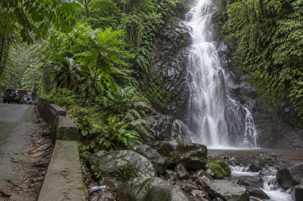
The core activities are scenic drives with roadside stops, short-to-moderate hikes, river swimming at the sites the Forest Service lists, and visits to the observation towers and El Portal, with adventure add-ons like ziplining, ATV riding and horseback riding on the forest's fringe. The classic self-guided day follows PR-191 North up from the entrance: La Coca Falls, an 85-foot roadside cascade at kilometer 8.1 that is a viewing and photo stop, not a swimming spot; Juan Diego Falls a little further up; Yokahú Tower; and then the upper corridor around Palo Colorado, Baño Grande and the Mount Britton trailhead. Trail and site closures change with construction and storm recovery, so the Forest Service's alerts page is the authority to check before you go, not any fixed list.
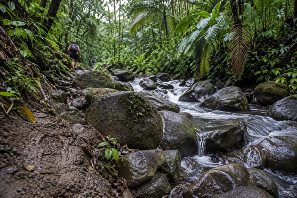
Hiking ranges from the 0.4 km Angelito Trail, an easy walk down to the Río Mameyes that the Forest Service recommends for families with younger children, to the El Toro Trail, a roughly three-hour climb through the wilderness to the highest peak. In between sit Mount Britton, a challenging 1.3 km climb with 591 feet of elevation gain to the stone tower, and the El Yunque Trail at 2.6 miles with 1,378 feet of gain. The trail network's most famous destination, La Mina Falls, has both of its access trails, La Mina and Big Tree, in closed status for extended periods following hurricane damage and construction, which is exactly why checking the live status matters. A full rundown of lengths, difficulty and current standing is in El Yunque hiking trails.
Swimming is where honest information pays off. The Forest Service lists swimming and wading as recreation opportunities at specific sites: the Juan Diego Falls pool, the Angelito Trail's Las Damas Pool on the Río Mameyes, Puente Roto, Quebrada Grande, Quebrada Sonadora, the Río Espíritu Santo observation point and the Río Sabana Recreation Area. It does not list swimming at La Coca Falls, at Baño Grande, which has been posted "no swimming permitted" since 1968, or at Baño de Oro, a former swimming hole that is now a photo spot. Flash flooding is the standing hazard at every one of these: the Forest Service warns that a sudden surge can claim victims in less than a minute, that flood water can reach 30 feet or more, and that the risk rises in the rainy months of April and May. Check conditions before getting in, and never cross or enter rising water.
Around the forest's edges sits a separate layer of activity that marketing copy often blurs together with the forest itself. The natural waterslides above Luquillo, known as Las Paylas, are on private land outside the national forest boundary, with no Forest Service management, staffing or safety oversight, and access arranged with the landowners on the spot. Carabalí Rainforest Park, at the forest's edge in the Río Mameyes valley, runs horseback riding, ATV and UTV tours on its own operation, and several zipline courses operate in the Río Grande and Luquillo area. These are real and popular, and many tours combine them with a forest stop, but they are not inside the national forest, and a listing that describes a waterslide day as an El Yunque rainforest tour is describing the region, not the federal land. The comparison is laid out in Carabalí Rainforest Park vs El Yunque.
For visitors who want the forest itself with a guide, the small-group sightseeing format is the most common entry point. The Let Me Show You My Island tour, rated 4.9 across 1,655 reviews and priced from $89, spends six to seven hours with hotel pickup and confirmed stops at La Coca Falls, Yokahú Tower and Piñones, a shape that mirrors the classic self-drive day while handing the driving and the parking to someone else.
What Is The Weather Like In A Rainforest You Can Drive Into?
Expect rain, not as a risk but as the baseline: annual rainfall runs from roughly 96 inches at lower elevations to 157 or more at the higher stations, it rains somewhere in the forest most days, and the temperature varies far less than the precipitation. The Forest Service's safety advice leads with footwear, quoting its own guidance: "Wear good shoes with traction: it is a rainforest, and it is a wet and mossy. Wet surfaces can be a hazard and even more so if it's on a slope." That is not boilerplate. The stone steps at Baño Grande, the trail surfaces and the roadside pullouts are routinely wet and slick, and most injuries in the forest come from slips, not wildlife.
The rain has a rhythm rather than a schedule. Mornings tend to be clearer, cloud builds through the day, and afternoon showers and summit cloud are common, which is one reason early arrival is the standard advice. The forecast authority for the forest is the National Weather Service's San Juan office, and because the rivers rise fast, the USGS stream gauge on the Río Mameyes publishes real-time discharge and height data that a swimmer can check before getting in. The Forest Service's flood guidance is blunt: a flash flood watch means threatening weather is possible, a warning means you may have only seconds, and during a surge you should get to higher ground rather than try to outrun the water in a car or cross a flowing stream.
None of this makes El Yunque a bad-weather destination; it makes it a rainforest destination. The cloud forest only looks like the cloud forest when it is in cloud, the waterfalls are fuller after rain, and a wet day here is a normal day here. What to pack for it, from footwear to dry bags, is covered in what to wear and bring to El Yunque.
Is El Yunque Worth Visiting, And How Do Tours Fit In?
For most travelers based in or passing through San Juan, yes: the forest is compact, free to enter, unlike almost any other tropical rainforest experience in a US territory, and combines easily with Luquillo's beach and kiosks into a single day. The forest supervisor has described the special recreation area as welcoming a million visitors annually, and the draw is easy to understand. Where else can you drive from a cruise port or a resort into a tropical rainforest in under an hour, stand on a CCC stone tower above the canopy, and be back on the beach by afternoon. The honest caveats are equally simple: the most famous waterfall trail has been closed for extended periods, the corridor is a single road that can fill on busy days, and the forest rewards visitors who check current conditions rather than arriving with a fixed itinerary from an outdated article.
Whether a tour is worth it depends almost entirely on transport and on how much you want explained. If you have a rental car, a willingness to arrive early and a habit of checking the Forest Service's current conditions page, you can see the corridor's highlights on your own for the cost of parking, which is to say nothing. If you do not have a car, the calculus changes sharply, because rideshare cannot pick you up at the corridor and unpermitted transport is a documented problem. A tour also buys local knowledge on what is open, which in a forest where trail status shifts with construction is not a small thing. The full breakdown of that trade-off is in can you go to El Yunque without a tour.
The most-booked format on this site's roster splits the difference: the 7-hour small-group rainforest and waterslide tour, rated 4.9 across 16,584 reviews and priced from $45, which pairs the forest side of the day with the Luquillo-side natural waterslides on private land. For a first-time visitor still working out what El Yunque even is, it is a reasonable shorthand for the whole region: rainforest in the morning, river and slides in the afternoon, transport and parking handled throughout.
Common Questions About El Yunque
What Is El Yunque In Puerto Rico?
El Yunque is a 28,516-acre tropical rainforest in northeastern Puerto Rico, managed by the USDA Forest Service and the only tropical rainforest within the national forest system. It sits across eight municipalities, with the main visitor corridor on PR-191 North in Río Grande, and entry to that corridor is free with no reservation required.
Is El Yunque a national park?
No. It is a national forest, a unit of the National Forest System managed by the USDA Forest Service, not the National Park Service. That is why entry to the recreational corridor is free, why the interagency passes are honored only at the El Portal visitor center, and why Forest Service alerts and trail-status pages govern what is open.
Do you need a reservation to enter El Yunque?
No. Entrance to the PR-191 North recreational corridor is free and no reservations are required, with hours from 8:00 a.m. to 5:00 p.m. The only bookable federal item is the El Portal visitor center ticket, $8 for adults 16 and over, and capacity on the corridor is managed through designated parking rather than a reservation system.
How big is El Yunque?
The forest covers 28,516 acres, about 11,540 hectares, which the Forest Service rounds to "nearly 29,000 acres." It is one of the smallest national forests but one of the most biologically diverse, rising from the coastal plain to El Toro Peak at 3,524 feet.
Can you swim at El Yunque?
Yes, at specific sites the Forest Service lists: the Juan Diego Falls pool, the Angelito Trail's Las Damas Pool on the Río Mameyes, Puente Roto, Quebrada Grande, Quebrada Sonadora, the Río Espíritu Santo observation point and the Río Sabana Recreation Area. La Coca Falls, Baño Grande and Baño de Oro are not swimming sites, and flash flooding is a serious standing hazard at every river spot.
Is the waterslide at Las Paylas part of El Yunque?
No. The natural waterslides above Luquillo sit on private land outside the national forest boundary, with no Forest Service management, staffing or safety oversight. Tours that visit them are visiting the Luquillo area, not the federal forest, and access is arranged with the landowners on the spot.