El Yunque Puerto Rico Weather: What Rain Really Means For Your Tour
El Yunque is a rainforest, and the rain is not a surprise, it is the point. Here is what the official rainfall record says, what the Forest Service warns about flash floods, and how to choose a tour that still delivers when the clouds open.
Short answer
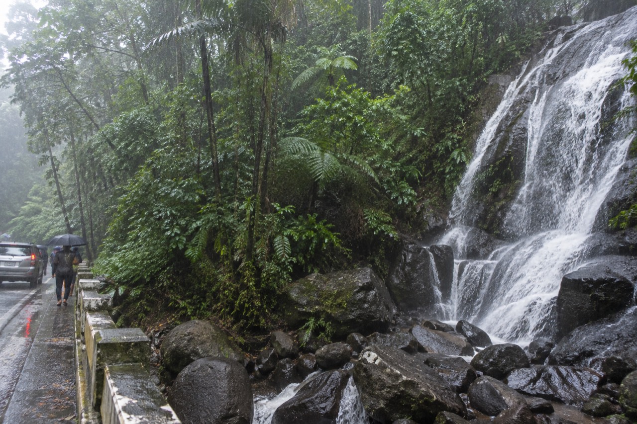
El Yunque receives roughly 96 inches of rain a year at lower elevations and about 169 inches at the peak, so some rain on your visit is near-certain. Tours generally run in rain, and the forest stays open, but flash floods can close river areas within minutes. Entry is free, no reservation is needed, and 8 a.m. to 5 p.m. are corridor hours.
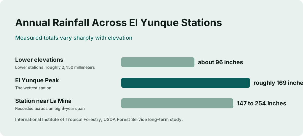
El Yunque National Forest is the only tropical rainforest within the national forest system, and the word rainforest is doing honest work in that sentence. Long-term research from the USDA Forest Service's International Institute of Tropical Forestry measures annual rainfall from about 2,450 millimeters at the lower stations to over 4,000 millimeters at the higher ones, which works out to roughly 96 inches at the bottom of the mountain and 157 inches or more near the top. The single wettest station in the record, at El Yunque Peak, averaged 4,300 millimeters a year, close to 169 inches.
That is the climate you are walking into. Most competing pages treat rain in El Yunque as an unlucky weather event that might spoil a booking. The Forest Service treats it as the design specification of the place. This guide takes the same view: rain is the condition that decides whether a tour delivers or disappoints, and planning for it, rather than hoping against it, is what separates a good El Yunque day from a soggy, frustrated one.
How Much Rain Does El Yunque Actually Get?
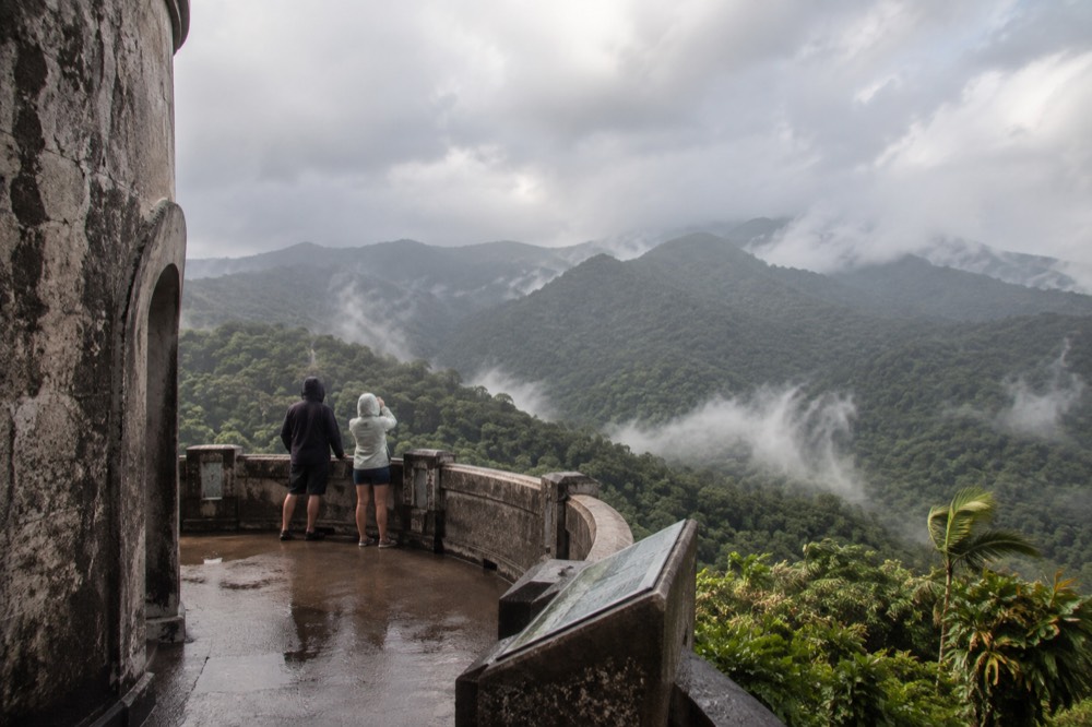
The measured record runs from about 96 inches a year at the lower elevations to roughly 169 inches at El Yunque Peak, the wettest station, and one station near La Mina recorded between 147 and 254 inches across an eight-year span. Rain falls somewhere in the forest most days of the year, usually in short, heavy bursts rather than all-day soakers. The forest does not close for rain.
Those numbers come from a long-term study published by the International Institute of Tropical Forestry, the Forest Service's own research arm in Puerto Rico. The researchers found that rainfall increases with elevation up to roughly 700 meters, which is why the drive up PR-191 often starts in sunshine and ends inside a cloud. Between 1994 and 1998, the twelve upper-elevation stations averaged about 4,500 millimeters a year between them, and the La Mina station alone swung from 3,730 to 6,450 millimeters across eight years of records. In inches, that low figure is 147 and that high figure is 254.
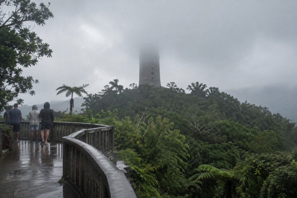
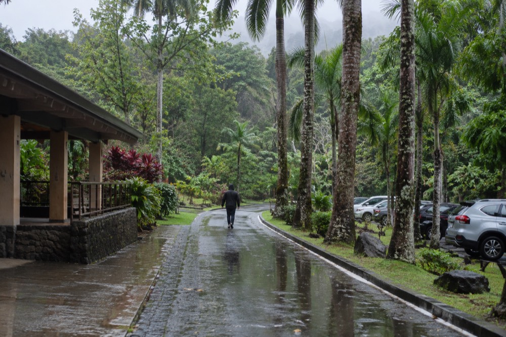
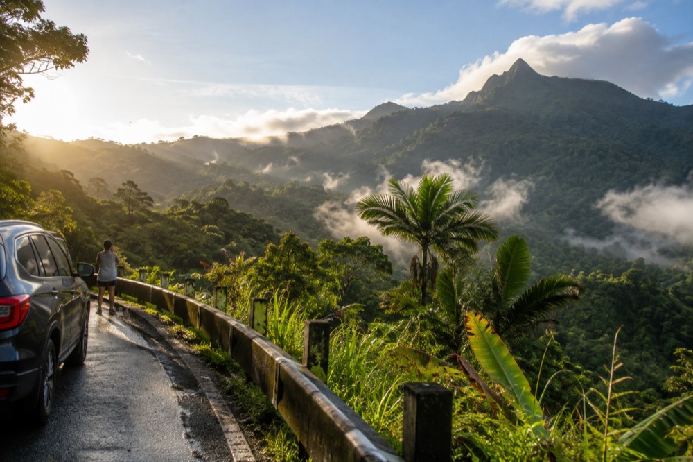
Two practical conclusions follow. First, the forecast for San Juan is a poor guide to conditions in the forest: the mountains make their own weather, and a day that looks clear on the coast can be wet at Yokahú Tower. Second, the rain is usually intermittent. Downpours in a tropical rainforest tend to arrive hard and leave fast, and the forest between them drips, steams and glows. Many visitors find that the hour after a shower, with mist rising off the canopy and the rivers running full, is the most photogenic hour of the whole day.
The National Weather Service office responsible for the El Yunque area is the San Juan forecast office, and the forest sits in forecast zone PRZ002. Checking that zone forecast the night before and again in the morning is the single most useful weather habit for this trip, far more useful than the generic island-wide forecast apps default to.
Does Rain Ruin An El Yunque Tour?
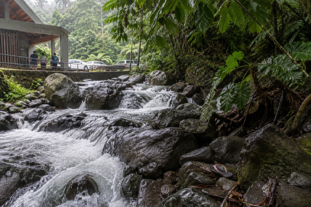
No, and in some ways it improves one. Tours in El Yunque run in rain as standard practice, because rain is the normal state of the forest, and the waterfalls and rivers you came to see are at their best when it has rained. What rain changes is footing, visibility and which water areas are safe, and a good guide manages all three.
The commercial reality is simple: operators in this forest do not cancel for a shower, and most do not cancel for steady rain either. The roster on this site reflects that. The 8-Hour Waterfall Hike with Pickup, rated 4.8 across 1,209 reviews and priced from $72, is built around river and waterfall time, and a wet day with the water running high is closer to the intended experience than a dry one. The Island Day Tour with Pickup Included, rated 4.9 across 1,655 reviews and from $89, mixes La Coca Falls, Yokahú Tower and the Piñones coast, and its stops are the kind that survive rain easily, since they are roadside viewing points rather than exposed climbs.
What rain genuinely changes is the risk profile around water. Slippery stone steps, muddy trail sections and swollen rivers are the real hazards, and the Forest Service's own preparation advice leads with footwear: the safety page tells visitors to wear good shoes with traction, because wet surfaces are a hazard and more so on a slope. That advice exists precisely because rain is routine here. If you want the full packing breakdown, the guide on what to wear and bring to El Yunque covers shoes, quick-dry clothing and rain shells in detail.
There is also a quieter argument for rain: crowds. Fine-weather weekends fill the designated parking areas along PR-191 early, and the Forest Service manages corridor capacity specifically because of parking limitations. A day with a wet forecast thins the crowds noticeably, and the visitors who do come out get the tower viewpoints and the falls more to themselves. If your tolerance for damp is high and your footwear is right, a rainy weekday is one of the better-kept secrets of this forest.
That said, honesty cuts both ways. Rain does not ruin a tour, but it can change one. Trails close, water areas get shut when rivers rise, and cloud can erase the view from Yokahú Tower entirely. The rest of this guide is about telling those situations apart, so you know when rain is atmosphere and when it is a reason to rebook.
What Does The Forest Service Say About Flash Floods?
Flash floods can occur year-round and are more frequent in April and May, and a sudden surge can claim victims in less than one minute, with flood water capable of reaching heights of 30 feet or more. The official advice is to monitor conditions, watch for heavy rain upstream, and move to higher ground rather than trying to outrun or outswim a flood.
This is the part of El Yunque weather that actually matters for safety, and the Forest Service publishes it plainly on its flooding page. A flash flood watch means threatening weather is possible; a warning means you may have only seconds to escape. The velocity of a surge can roll boulders and vehicles, tear out trees, destroy bridges and undermine roads, which is why the agency's checklist tells visitors never to cross flowing streams and never to try to swim to safety.
The key word in the official advice is upstream. The rain that floods your swimming hole may be falling a mile away on the upper slopes, in weather you cannot see from the riverbank. This is the single most common trap for independent visitors: the sun comes out, the pool looks calm, and water from a storm upstream arrives minutes later. Guides who work these rivers daily watch the upstream weather and the water color, and that judgment is a real part of what a permitted operator is selling.
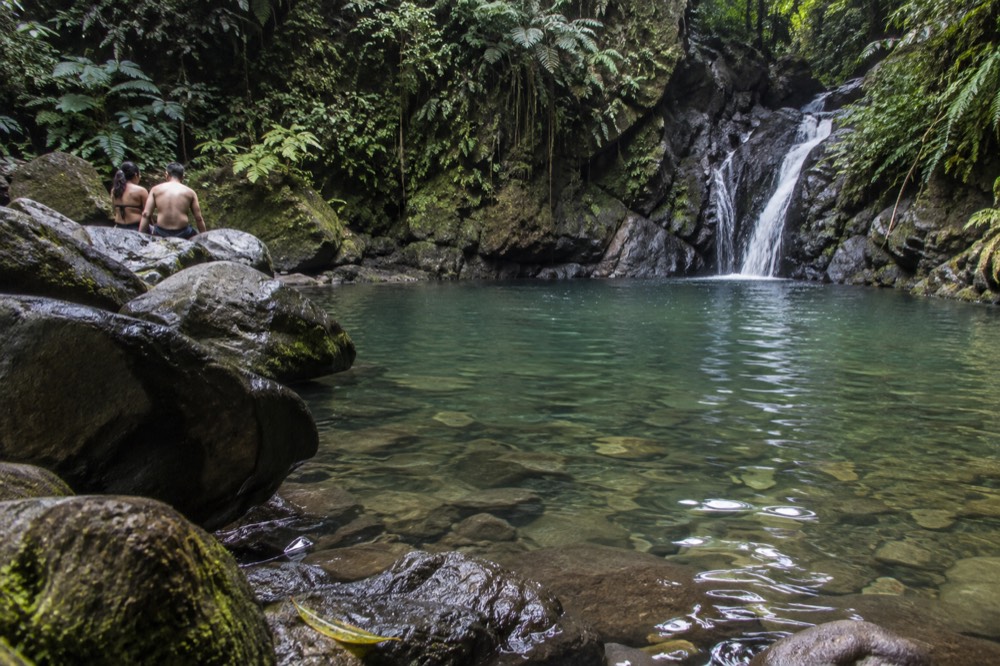
Two live tools are worth bookmarking. The Río Mameyes, the river the Angelito Trail leads down to, has a real-time USGS stream gauge (site 50065500) publishing discharge and gage height, so you can check the river before you get in, and the Río Espíritu Santo has a National Weather Service gauge page listing flood stages and recent crests. The Forest Service also repeats its flash-flood warning on individual trail pages, including the Angelito and Bisley trails, telling visitors to be aware of current conditions and flash flood reports for the area.
For the practical question of whether your specific water spot is safe on a specific day, the Forest Service's current conditions page is the authority, and the alerts index carries trail and site status. Check both the morning of your tour.
A tour is not a substitute for that check, but it is a complement to it. A permitted guide is reading the same alerts, watching the same gauges and making the call on which river stops are viable that day, which is exactly the kind of judgment that is hard to improvise from a rental car with patchy signal in the mountains.
What Should You Wear And Pack For A Rainy El Yunque Day?
Traction shoes, quick-drying clothes and a light rain shell are the core kit, with the Forest Service's own advice leading on footwear: wet, mossy surfaces are a hazard, and more so on a slope. Skip cotton, skip umbrellas on trails, and bring a dry bag for phones. Water shoes matter only if your itinerary includes river time.
The Forest Service safety page puts it in its own words: wear good shoes with traction, it is a rainforest, and it is wet and mossy. That is the agency telling you, in one sentence, what a quarter of first-time visitors get wrong. The stone steps built by the Civilian Conservation Corps in the 1930s, which carry most of the foot traffic on PR-191, are polished by decades of rain and become genuinely slick within minutes of a shower. Running shoes with worn soles are the most common cause of minor injuries here.
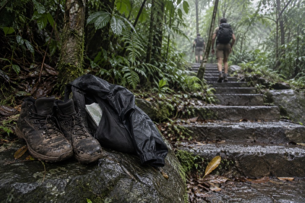
Beyond shoes, the packing logic of a rainforest is the opposite of a beach day. Cotton stays wet for hours and chills you at elevation, where cloud forest air is noticeably cooler than the coast. Synthetic or merino layers, a cheap poncho or light shell, and a dry bag for electronics cover most of it. A full kit list, including the water-shoes question and what changes with kids, is in the what to wear and bring to El Yunque guide.
| Item | Why it matters in rain | Priority |
|---|---|---|
| Shoes with aggressive traction | CCC-era stone steps and mossy rock are slick when wet | Essential |
| Quick-dry layers (no cotton) | Cloud forest air is cool; wet cotton chills you at elevation | Essential |
| Light rain shell or poncho | Downpours are heavy but usually short | High |
| Dry bag or ziplock for phone | Rain plus river spray plus humidity | High |
| Towel and change of clothes in the car | Comfort for the drive back to San Juan | Nice |
| Reef-style water shoes | Only if your itinerary includes river or waterslide time | Situational |
One item deserves a specific warning: the umbrella. On a roadside stop like La Coca Falls it is fine. On any trail it is a nuisance in the wind and a hazard on narrow, slippery passages where you want a free hand. Rain shells win on trails, every time.
Which El Yunque Trails Hold Up Best In The Rain?
The Angelito Trail on Road 988 is the best all-conditions short walk, an easy 0.4 km down to the Río Mameyes, while the Mount Britton Trail, 1.3 km with a 591-foot climb, is the best rainforest-immersion hike that does not depend on a summit view. Trail status in this forest changes with construction and storm damage, so the alerts page is the live authority on what is open.
Rain changes what a trail is worth, and not equally. A viewpoint hike in cloud, like the upper stretches toward El Yunque Peak, can deliver a white wall where the panorama should be. A forest-interior hike, walking through tabonuco and palm forest with water running off every leaf, loses almost nothing. Mount Britton's stone tower, built by the CCC in the late 1930s, sits at 3,087 feet and is often in cloud, but the trail itself, crossing two mountain streams under closed canopy, is arguably better in rain than out of it. The rest of the planning pages sit on El Yunque National Forest Tours.
The Angelito Trail is the family pick: 0.4 kilometers one way, 132 feet of elevation change, rated easy, descending through tabonuco trees to the federally designated Wild and Scenic Río Mameyes and its Las Damas Pool. The Forest Service describes it as a nice trail for families with younger children. It carries the standard flash-flood warning, so river access is the part to supervise, not the walk down.
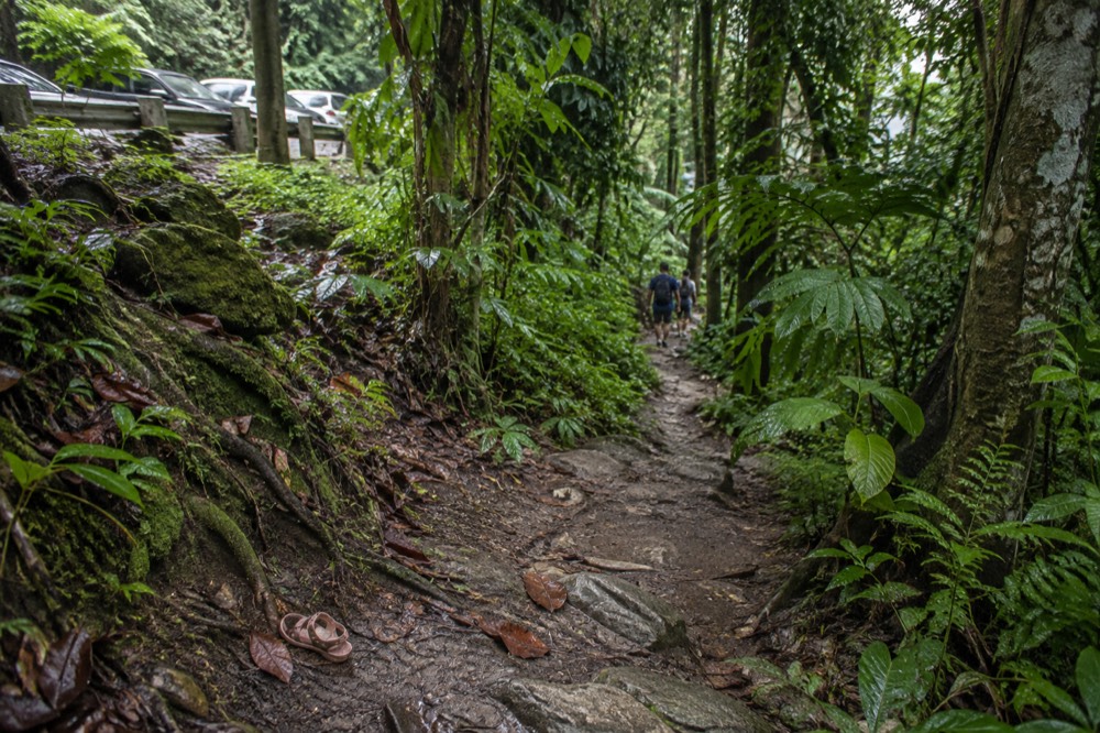
Closures are the wildcard. Trail and site closures in El Yunque change with construction and storm damage, and this site does not bake them into prose as standing facts. The Forest Service's forest trails status alert is the page to check before you plan a route. For a fuller rundown of routes by difficulty and length, see El Yunque hiking trails.
| Trail | Length | Difficulty | How it handles rain |
|---|---|---|---|
| Angelito Trail | 0.4 km one way | Easy | Excellent; short, sheltered, river at the end |
| El Portal interpretive loop | 0.3 mi | Easy | Excellent; packed gravel, accessible sections |
| Mount Britton Trail | 1.3 km | Challenging | Good; streams run high, tower may be in cloud |
| El Toro Trail | 2.3 mi | Difficult | Muddy and remote; best saved for dry days |
| La Coca Trail | 1.8 mi | Very Challenging | Poor; the FS notes it loses the most people |
That last line is worth pausing on. The Forest Service's own description of the La Coca Trail calls it one of the trails where the agency loses the most people, meaning search-and-rescue calls, and its difficulty rating is Very Challenging. In rain, with 656 feet of elevation change and wet crossings, it is a trail for experienced, prepared hikers only, and not something to attempt because it starts near the falls parking.
Should You Book A Tour If Rain Is In The Forecast?
Yes, and the free-cancellation policies on most of this roster make it low-risk. Rain alone rarely cancels an El Yunque tour, operators simply adjust which water access and trail stops are viable, and a permitted guide solves the two problems rain makes worse: parking pressure and judging river safety.
Start with what a tour does not buy you, because a lot of outdated copy implies otherwise. Entry to the PR-191 North recreational corridor is free and no reservation is required, so there is no reservation queue for a tour to skip you past. What a tour actually provides is a permitted vehicle and a legal drop-off, which matters because parking is the real constraint here, the Forest Service manages capacity around designated parking areas, and rideshare apps cannot legally pick up at the corridor or El Portal. A rainy day compresses that problem further, as everyone crowds into the same sheltered stops.
The 8-Hour Waterfall Hike with Pickup, rated 4.8 across 1,209 reviews and priced from $72, is the strongest rain-weather booking on the roster for one reason: an eight-hour window gives the guide room to work around weather. A half-day product has to deliver its stops in sequence; a full-day one can wait out a squall, reroute to the Naguabo or Luquillo side, or linger where the forest is at its best. It includes hotel pickup, which removes the parking and rideshare problems entirely, and it offers free cancellation, which removes the booking-risk problem.
If rain looks likely to dominate the whole day rather than punctuate it, the Island Day Tour with Pickup Included is the resilient alternative. Rated 4.9 across 1,655 reviews and from $89, it runs six to seven hours with confirmed stops at La Coca Falls, Yokahú Tower and Piñones, a mix of roadside forest stops and coast. When the mountain is socked in, the coastal leg still delivers, and the day does not collapse. It also includes hotel pickup and free cancellation.
For travelers who want the rain to be the entertainment rather than the obstacle, there is a third path: the Hike and Zipline Combo, rated 4.7 across 21 reviews and from $225 for a nine-and-a-half-hour day. Zipline courses in this forest run in light rain, and a wet canopy is a louder, greener, more kinetic place to fly through. The long duration again gives the operator room to sequence stops around the weather.
The booking decision, in short, is less about whether it will rain and more about how much slack your itinerary has. Short, fixed-sequence tours are the most fragile in weather; long tours with mixed stops and a guide making live calls are the most dependable. Free cancellation, which nearly every product on this roster carries, means you can commit early and adjust if a real system arrives.
What About The Waterslides When It Rains?
The natural waterslides near Luquillo sit on private land outside the national forest, with no Forest Service management or safety oversight, and rain raises the stakes there because river conditions change faster than anyone supervises them. Several tours on this roster include them, and that private-land status is part of what you are buying.
This is the honesty point that most El Yunque content gets wrong. The slides known as Las Paylas are not inside El Yunque National Forest. They sit on private land in Luquillo, outside the forest boundary, verified against the Forest Service's own GIS layers, and the Forest Service does not manage them, staff them or list them among its recreation sites. Access is arranged with the landowners on the spot. No verified public figure exists for an access fee, hours or walking time, and this site will not invent one.
Why does this matter for a rain decision? Because the safety net is different. Inside the forest, the Forest Service posts flash-flood warnings, publishes trail status and manages water access at its listed swimming spots. At the private slides, none of that applies. Rain that is merely atmospheric at Yokahú Tower is a live variable on an unsupervised river slide. Tours that visit the slides bring their own guides and their own judgment, which is the practical mitigation, and reviews on those listings frequently describe exactly that, guides calling the conditions and adjusting the plan.
| Water spot | Managed by | Rain consideration |
|---|---|---|
| Juan Diego Falls pool | Forest Service | Listed swimming; 30-minute parking limit |
| Angelito Trail, Río Mameyes | Forest Service | Listed swimming; flash-flood warning applies |
| Puente Roto, Quebrada Grande | Forest Service | Listed swimming; check conditions |
| Las Paylas slides | Private land, no Forest Service oversight | Conditions change with rain; tour guide judgment applies |
Inside the forest, the swimming opportunities the Forest Service itself lists include the Juan Diego Falls pool, the Angelito Trail stretch of the Río Mameyes with Las Damas Pool, Puente Roto, Quebrada Grande, Quebrada Sonadora, the Río Espíritu Santo Observation Point and the Río Sabana Recreation Area. Each carries the flash-flood warning, and each should be judged against the day's conditions. If a tour listing promises swimming at a spot the Forest Service does not list it for, treat that as the operator's claim about their own itinerary, not a forest-wide permission.
When Is The Best Time To Visit El Yunque Weather-Wise?
There is no dry season in any meaningful sense: rain falls year-round, flash floods are most frequent in April and May, and the practical levers are arrival time and day of week rather than month. Arriving at the 8 a.m. opening gives you the best odds of thinner crowds and clearer air before afternoon cloud builds on the peaks.
The monthly question is the one every visitor asks and the honest answer is that the rainfall record does not support a clean answer. The lower stations get about 96 inches a year spread across the calendar; the upper stations get more. What does vary is the pattern: much of Puerto Rico sees afternoon convection, where morning sun builds into afternoon showers over the mountains, which is why early starts are disproportionately rewarded here. The corridor opens at 8:00 a.m. and closes at 5:00 p.m., with the Forest Service advising visitors to begin exiting at least 15 minutes before closing.
The deeper planning question, timing versus season, is covered in the best time to visit El Yunque, and the morning-versus-afternoon tradeoff gets its own treatment in the site's planning pages. The short version for a rain-focused reader: mornings are cooler, less cloudy on the peaks and less crowded in the designated parking, and the three most time-limited stops, Yokahú Tower and Juan Diego at 30 minutes of parking each, are far easier to work in before midday.
Hurricane season, June through November, is the one calendar factor worth naming plainly. A named storm approaching Puerto Rico will close the forest and cancel tours, and that is a different event from rain. The free-cancellation policies across this roster exist for exactly that scenario, and the Forest Service alerts page is the authority on any closure.
Common Questions About El Yunque In The Rain
Does it rain every day in El Yunque?
Rain falls somewhere in the forest most days, though usually in bursts rather than all day. Annual totals run from about 96 inches at lower elevations to roughly 169 inches at the peak, so a completely dry day is the exception, not the rule.
Do El Yunque tours get cancelled for rain?
Almost never for ordinary rain, because rain is the normal climate of the forest. Tours are cancelled for named storms, forest closures or dangerous river conditions, and nearly every product on this roster carries free cancellation so you can adjust if that happens.
Is El Yunque worth visiting in the rain?
Yes, with the right footwear. The waterfalls run fuller, the crowds thin, and the forest is at its most photogenic as mist lifts after a shower. What rain costs you is summit views and some water access, so a mixed itinerary with a guide handles it best.
What is the flash flood risk in El Yunque?
Flash floods can occur year-round and are more frequent in April and May. The Forest Service warns that a surge can claim victims in less than one minute and reach heights of 30 feet or more, so never cross flowing streams and move to higher ground if water rises.
Does El Yunque close when it rains?
No, the recreational corridor operates 8:00 a.m. to 5:00 p.m. rain or shine, and entry is free with no reservation required. Closures come from construction, storm damage or named storms, and the Forest Service alerts page is the live authority on any of them.
What shoes should I wear for El Yunque in the rain?
Shoes with real traction, per the Forest Service's own advice: the forest is wet and mossy, and wet surfaces on a slope are a hazard. Water shoes only matter if your itinerary includes river or waterslide time.